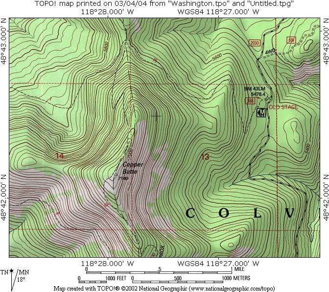
Copper Butte
Low Point: 5500'
High Point: 7140'
Season: Summer/Fall
Difficulty: 0/5
Directions
From Kettle Falls, WA, drive west on U.S. Highway 395 across the Columbia River (Lake Roosevelt). Take a left (west) on Highway 20 towards Republic, WA. After 18.4 miles, look for Albion Hill Road #2030 on the right. Go north on Road #2030 for 7.3 miles to the "Old Stage Road Trail 75" trailhead.Trail Description
7/2/2004: This easy-to-moderate hike is a great way to "bag" a 7,000-footer. The Old Stage Road Trail #75 (the first half of the trek) is 8' wide and the slope is gradual. The Backcountry Horsemen of WA use this trail (which used to be a stagecoach route in the 1890s). It's open to mountain bikes, hikers, and cross-country skiers too, but no motorized vehicles.
I returned to this mountain after a 9-year hiatus. My last visit in 1995 was a year after the 11,000-acre forest fire that consumed much of the forest around Copper Butte. During that hike, the forest was black and eerily quiet; there was no green vegetation in the burn area. I'm glad to see that the forest is recovering, and there's 2'-3' high firs and green brush covering all of the slopes. The growing season is so short, that it will take decades for the trees to grow as high as the 50'-high fir forest that burned in 1994.
The first half of the 1.6-mile, gentle climb up Trail #75 is through a live fir forest. Then, you enter the burn area. Most of the dead timber is still standing, with trunks bleached from the sunlight. A trail maintenance crew had recently chainsawed all ~75 logs that had fallen across the route up Copper Butte, so the trail was in excellent shape. However, this trail will require a lot of annual maintenance as the timber rots and falls across the trail.
At a saddle between Midnight Mountain (6,660 feet) and Copper Butte, you intercept the north-south Kettle Crest Trail #13. Take a left (south) up the western flanks of Copper Butte. There is a pair of wooden signs, so you won't miss the turnoff. As you climb up the moderately-steep section, you can see the Curlew Valley off to the west through the stands of dead timber. You gradually climb up higher than Midnight Mountain, which is the next peak along the Kettle Crest to the north.
There were two small patches of snow remaining on the unburnt summit. Various rock cairns mark the spot of an old lookout tower. A weathered flagpole has a 5"x7" gold plaque that says "In Loving Memory of Tobias C. Buchanan, 1980-2002." I saw the USFS Triangulation Station brass marker set in 1925. Just north of the summit, there are orange triangles painted on the rocks and a big "10" sign for a helicopter landing area.
From the summit, you can see the Kettle Crest extending southwards. Scar Mountain (7,046 feet) is next door to the south, then just beyond it is Wapaloosie Mountain (7,018 feet). These mountains take more work to climb than Copper Butte (since you must bushwack a ways up both peaks).
If you want to climb the highest peak in the Kettle Range, and the highest point in Ferry County, WA, Copper Butte is for you. You can see the North Cascades to the west on a clear day, but the skies were a bit hazy this time. Interestingly enough, the forest fire improved the distant views greatly.
.jpg)
.jpg)
.jpg)
.jpg)
.jpg)
.jpg)