Surprise Lake
Low Point: 4030'
High Point: 6000'
Season: Summer/Fall
Difficulty: 3.25/5
Directions
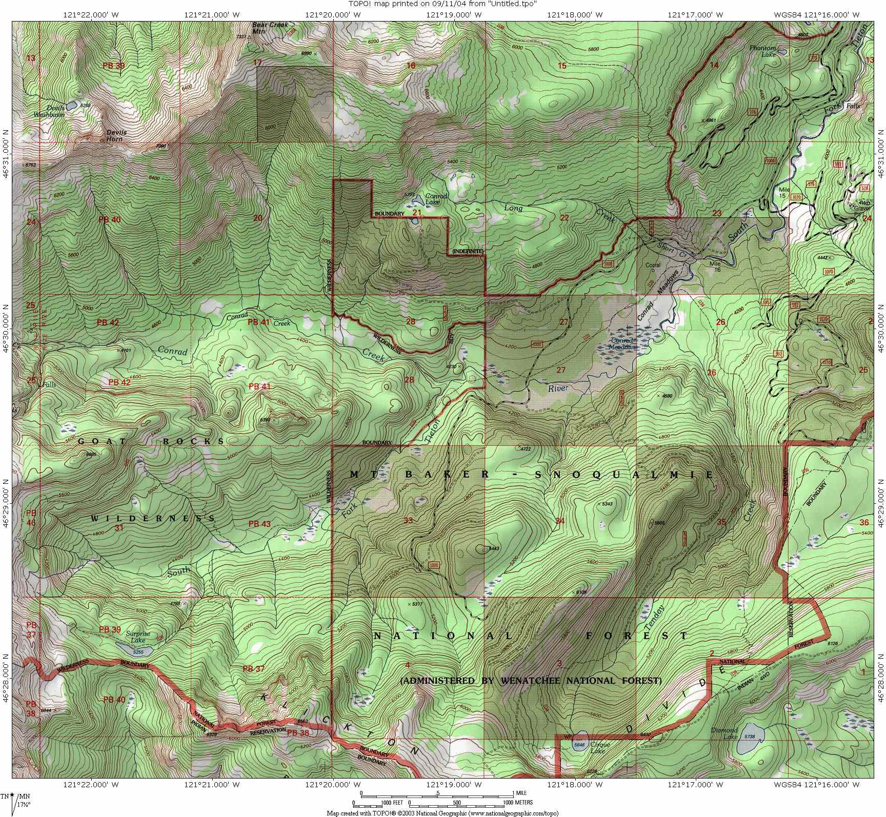
Drive Highway 12 east from Packwood for 29 miles until reaching a sign for Clear Lake. Turn south (right) onto Forest Service Road 12 and follow this around to the south-eastern shore of the lake and south onto Forest Service Road 10. Follow this road to its end and the trailhead.Trail Description
The trail to Surprise Lake offers relatively easy access to some of the great alpine country of the Goat Rocks Wilderness. The lake is beautiful, but the even greater country comes beyond the lake, so be sure to spend extra time in the area to fully explore the mountain country. Because this trail is also used by horses, expect plenty of dust and unfortunately, quite a bit of trail erosion.
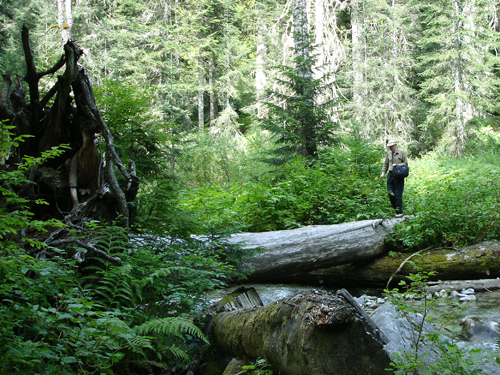
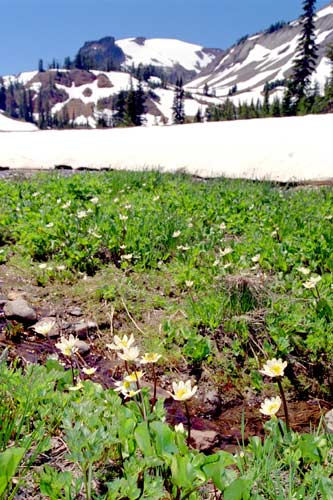
From the parking area, follow the gravel road a quarter-mile, until reaching a gate and a sign pointing the way to Surprise Lake and the South Fork of the Tieton River (trail 1120). The trail immediately crosses two small creeks (Short Creek, and Long Creek). Neither of the creeks are especially deep, but crossings are provided with logs. After the stream crossings, the trail emerges in the first of many beautiful meadows with views up the valley towards the mountains.
This first section of trail can get confusing with a variety of side trails. My hunch is that they all end up in the same place, so I wouldn’t worry too much, just try to stay on the well-traveled path. There is one intersection where a split in the trail gives the hiker apparently two equal paths. While the right-most path eventually meets up with the main trail, the actual path stays left.
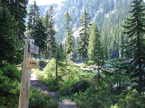
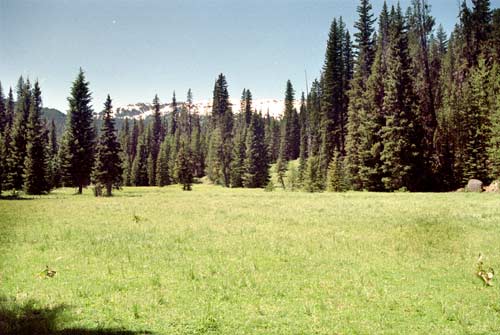
After a mile, the trail crosses the road, but beyond lies the trail registration box, and wilderness. More beautiful meadows await, as the trail parallels the beautiful South Fork of the Tieton River with a mixture of pines and firs towering overhead. A mile past the road crossing, the trail drops to the clear, cool and very refreshing Conrad Creek as it joins with the South Fork Tieton River.
Beyond Conrad Creek, the scenery only gets better, with several meadows intervening with the mix of Ponderosa Pines, Douglas Fir, Cedar, and Aspens. Look for elk and other wildlife in the meadows, especially if you are hiking through in the morning or evening. At the four-mile mark, the trail splits, creating the opportunity for a nice loop trip, so it doesn’t matter too much which fork you take. We took the path to the left, which allows quicker access to Surprise Lake. Continuing via the left fork, the path continues on its pleasant grade until crossing the South Fork Tieton River at the 4.5 mile mark.
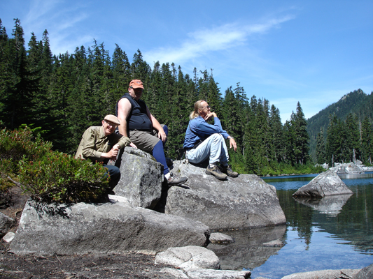
After crossing the South Fork, the trail starts its switch-backing ascent up the south wall of the beautiful river canyon, zigzagging it’s way between to streams that combine to create the South Fork. There is a beautiful waterfall halfway up this ascent, which can be pretty dusty due to the Horse Traffic. Views of the surrounding peaks also become clearer as the climb progresses. After a mile of climbing, the trail levels off and reaches Surprise Lake, a nice, greenish-blue lake, surrounded by a fairly dense forest. Campsites can be hard to find, there are a couple of large horse-camps at either end of the lake. If you have more energy, you may consider continuing a half-mile past the lake to the upper meadows, where the country is distinctly alpine and campsites are in greater supply.
The land past Surprise Lake is great for exploring. Continuing along the loop trail, about a mile past Surprise Lake, look for a pretty well used side trail leading to the left. On our visit, this trail was signaled with a blue marker tied to a tree. This path climbs fairly steeply for three quarters of a mile, before reaching a saddle and dropping into the Conrad Creek Valley. The meadows, waterfalls, and mountain views easily make this portion of the trip the highlight; so if you have the time, make sure to explore this area. There are also several nice campsites in this basin that provide good base camps for exploratory trips around the area.
**Mileage given includes only the loop, and not the other suggested side trails.