Park Meadow and Golden Lake
Low Point: 6350'
High Point: 7100'
Season: Summer/Fall
Difficulty: 0/5
Directions
Start from the town of Sisters, which is located 20 miles west of the Santiam Pass along Highway 20 in Central Oregon. In the middle of town, look for Elm Street... turn south and stay on Elm Street, which will become Road 16. After 14 miles of pavement, you will continue 0.3 miles on gravel until you come to a sign for the Park Meadow Trailhead to your right. Follow that gravel road for another 1.1 miles to an open parking area. NOTE: This road is rough, but passable for normal-clearance passenger vehicles... just take it slowly.A Northwest Forest Pass is required to park at this trailhead. After parking, continue walking approximately 0.1 mile to the actual trailhead.
Trail Description
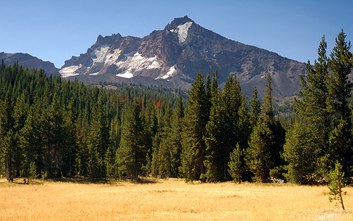
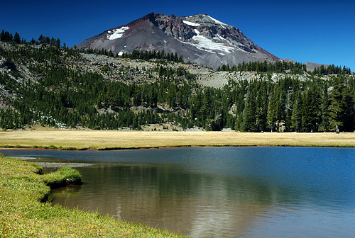
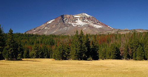
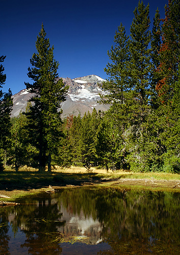
Park Meadow and Golden Lake are located just north of Broken Top and east of South Sister. The mountain views are unbelievable!
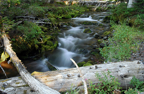
From the trailhead, start downhill on the dusty trail. At 0.8 mile you will cross a tiny branch of Snow Creek, and just past the one mile mark you will cross Snow Creek proper, the first of three photogenic creek crossings along this trail. Ignore side trails and continue straight past the hiker registry box into the Three Sisters Wilderness. In another 1.5 miles you will cross Squaw Creek, which is fed by the Bend Glacier on Broken Top. Assuming that you start your hike in the morning, it may look fairly docile, but it will be quite different on your return trip when the snow melt turns it into a milky torrent.
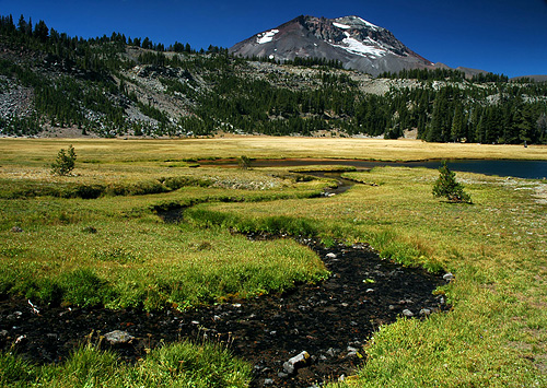
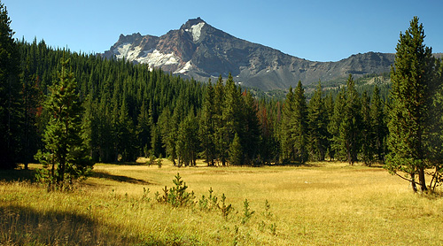
After climbing gradually for a mile beyond the Squaw Creek crossing, you will enter Park Meadow. You will see a tiny lake on your left which provides a nice morning reflection of South Sister. Slightly beyond that lake, you will cross Park Creek. Immediately after that crossing you will see a small use trail to your left... that leads to a nice creek-side view of Broken Top. If you stay on the main trail, after 50 feet you will see a small trail leading off to the right. This leads to the Pole Creek trailhead, so you will want to bear left on the main trail. If you are going the right way, you should then see a sign nailed to a tree on your left indicating that Green Lakes is another 3+ miles.
After enjoying the views from Park Meadow, cross it on the main trail, and then start climbing. After 0.4 miles, the trail makes a sharp switchback to the right. Continue approximately half a mile. The side trail to Golden Lake is unmarked, so watch carefully for a 100 foot stretch of open trail, followed by relatively small trees on both sides of the trail. Immediately beyond these two trees, turn left onto a narrow trail, which is also marked by a small stone cairn. Continue on this trail, which is sometimes quite narrow but always clear, for just under a mile to a "Golden Lake" sign. Shortly beyond that sign, you will come to a fork in the trail... go left to follow the creek to the lake. The right fork will also take you to the lake, albeit with a slightly less direct route.
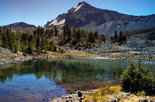
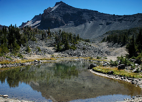
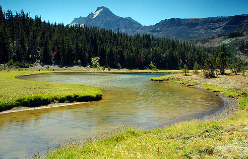
From Golden Lake you will enjoy more fine views of Broken Top and South Sister. After taking a well-deserved break, continue on the last mile of the trail to a pair of lovely tarns with AWESOME views of Broken Top. Follow a trail around Golden Lake to a small cascade which drops into the lake on its south side. From here you can either continue on that trail as it veers left up the hill, or follow the creek upstream next to the cascade... either way will get you to the same spot. The trail follows this beautiful unnamed creek for just under a mile to the first of the two tarns. To reach the second (upper) tarn, proceed right and walk counter-clockwise around the lower tarn... it's less than a ten minute walk.
As you descend from the tarns back to Golden Lake, you will be stunned by incredible views of all of the Three Sisters. If the weather is clear, you will also see Mount Washington, Mount Jefferson, and perhaps even Mount Hood 90 miles to the north.
CAVEAT: The first 2.5 miles of this trail (to Squaw Creek) may seem quite tame. Indeed, you drop 350 feet in elevation... the climbing doesn't really start until after Park Meadow. However, make sure that you are mentally prepared for the return trip, because that 350 foot elevation gain seems a lot tougher after you have already hiked 10+ miles. (Or maybe it just seemed that way because, as always, I was lugging my tripod and camera gear.)