Packwood Lake
Low Point: 2800'
High Point: 3200'
Season: Summer/Fall
Difficulty: 2/5
Directions
From the north end of Packwood, Washington turn east onto Snyder Rd. Go six miles on thispaved road, following the signs, to the trailhead. A NW Forest Pass is required.
Trail Description
From the trailhead two trails go to the lake, one is open to motorcycles, the other is for hikers and
equestrians only. Motorcycles are not allowed on any of the trails around the lake. The hiking
trail, is a wide, well maintained trail, and is under a canopy of younger evergreens with some
large old growth fir and cedar mixed in. At about a mile there is a good view of the valley below
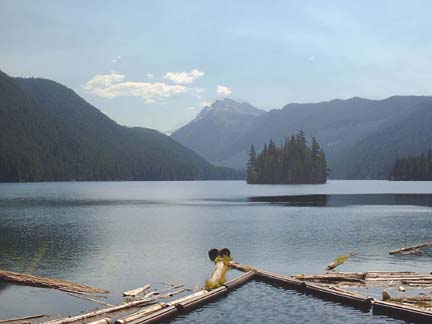
and Mt. Rainier. Packwood Lake is a large, beautiful lake with an interesting island and Johnson
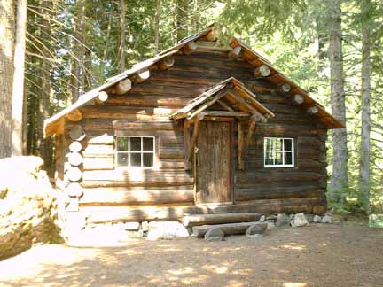
Peak rises above the south end of the lake. An old restored rangers cabin is at the north end of the
lake.
Starting at about 2800' elevation the trail climbs gradually for about two miles to 3200'. It then
descends a little before it becomes nearly level for about two miles. The trail descends about 200'
in the last half mile to the lake at 2857'.