Mt. Hood Meadows Loop
Low Point: 5800'
High Point: 4500'
Season: Summer/Fall
Difficulty: 0/5
Directions
The trail leaves from the Sahalie Falls Trailhead. From Hood River, head south on Highway 35 for 32 miles to a junction with FR 3545 (There is also a sign for the Hood River Meadows Nordic Center). Turn right and proceed a half mile to a small parking area on the right side of the road. FR 3545 can also be accessed for those travelling eastbound on Highway 35. The turn is approximately 7.5 miles past the Highway 26 interchange.Trail Description
This nice day hike samples the alpine country on Mt. Hood's southeast slope. While not the most wild trip (you will walk under ski lifts,and near the Mt. Hood Meadows Ski Area), you will experience great scenery.
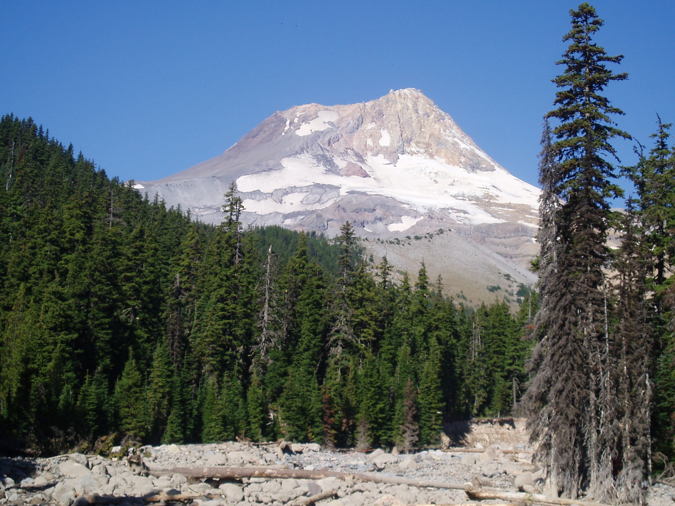
From the trailhead, the trail gradually climbs through small fir and hemlock trees before crossing Clark Creek on a small bridge. A little over a half mile past Clark Creek, the trail nears Newton Creek, and the Newton Creek Trail. Turn left at the trail junction onto Newton Creek Trail. This path, much less popular can be a little brushy, but the path is generally easy to follow as it climbs (fairly steeply in places) towards Mt. Hood as it follows Newton Creek. The wide channel of Newton Creek provides for good views up and down the valley. The trail switchbacks once and follows a ridge to where it meets the Timberline Trail.
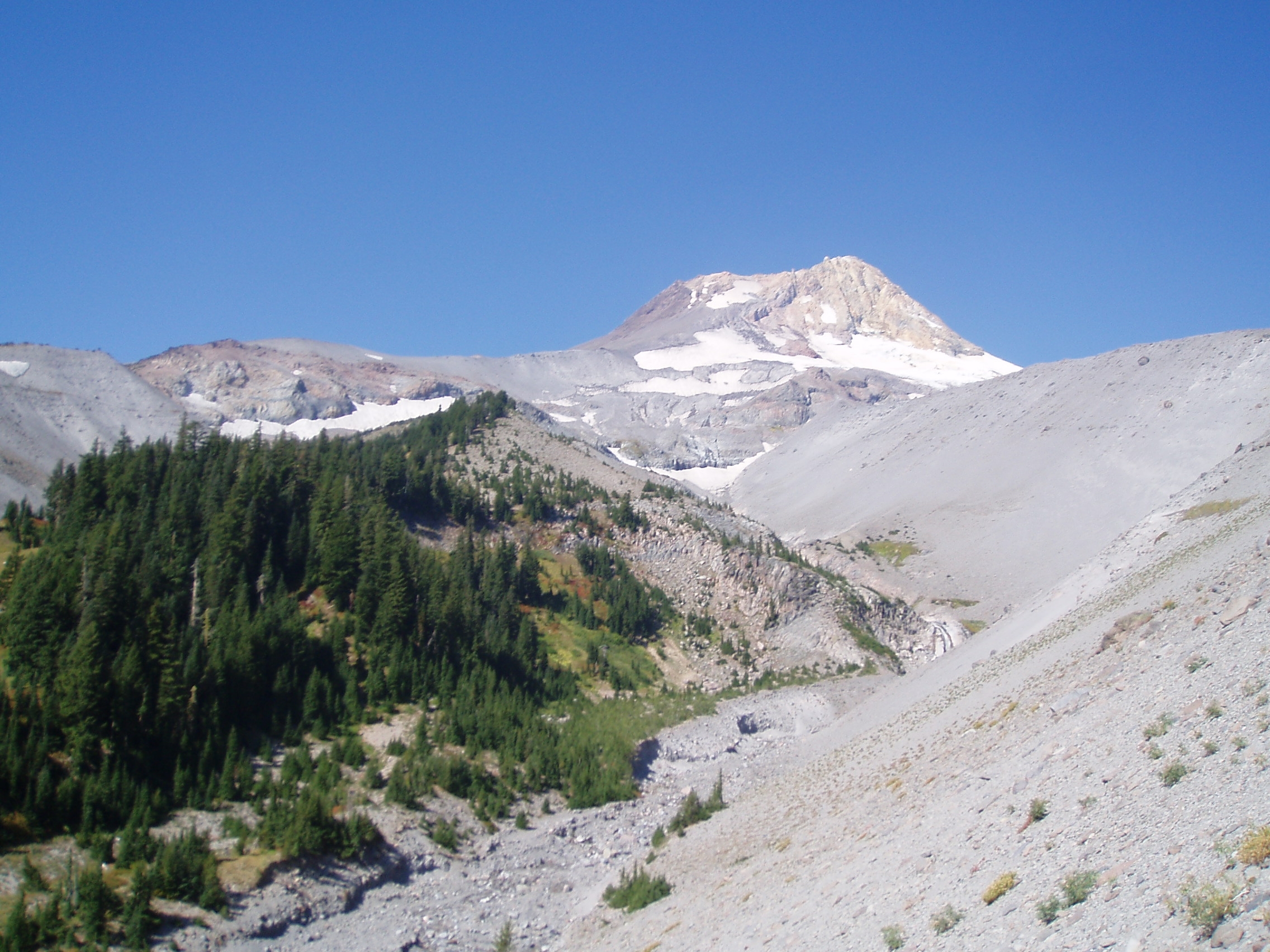
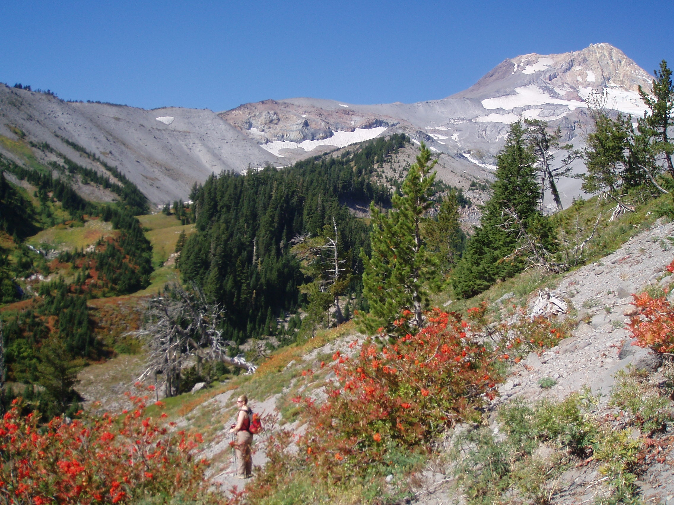
Turn left along the Timberline Trail, as path winds around a ridge and enters the Clark Creek Drainage with fantastic views of Mt. Hood and the meadows along the the West Fork Clark Creek. The trail crosses the eastern fork of Clark Creek, which can be a bit tricky, particularly early in the season. During our September trip we were able to rock-hop the crossing, but this could be a tougher crossing earlier in the season. The trail then ascends into meadows and small stands of trees, before crossing the western fork of Clark Creek (an easier crossing than the east fork). The western fork is a beautiful creek, as it cuts it's way through the meadows, with nice waterfalls on either side of the trail crossing.
The trail then climbs through the trees, rounds a ridge, and confronts the first in a series of ski lifts. The scenery is nice through this section, but the ski lifts do detract from the 'wild' feeling. Continue past several more ski lifts, and around the bowl of Mt. Hood Meadows to the Umbrella Falls Trail, which is accessed just past a road crossing (and about 3.5 miles from the Newton Creek Trail).
Turn left on the Umbrella Falls Trail (tr 667), and follow this as it descends past the ski area, crosses the paved road leading to Mt. Hood Meadows, and continues on towards Umbrella Falls. Just beyond the falls, take another right turn onto trail 667C and follow this path as it descends back towards Hood River Meadows. You can also access Sahalie Falls along a side trail that leaves from trail 667C. To return to the trailhead, continue straight at this junction. The trail will cross Road 3445 once, and continue a very short distance to meet the trailhead on the other side of the road's switchback.