Snowshoe Peak
Low Point: 2400'
High Point: 8736'
Season: Summer/Fall
Difficulty: 0/5
Directions
Take highway 56 about 20 miles north of Noxon, Montana and turn right on Road 410. Drive two miles to its junction with road 2722. The trail begins here.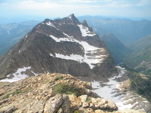
Trail Description
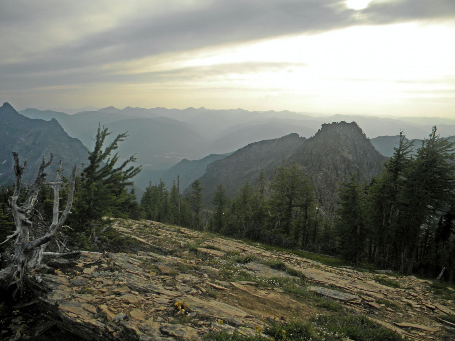
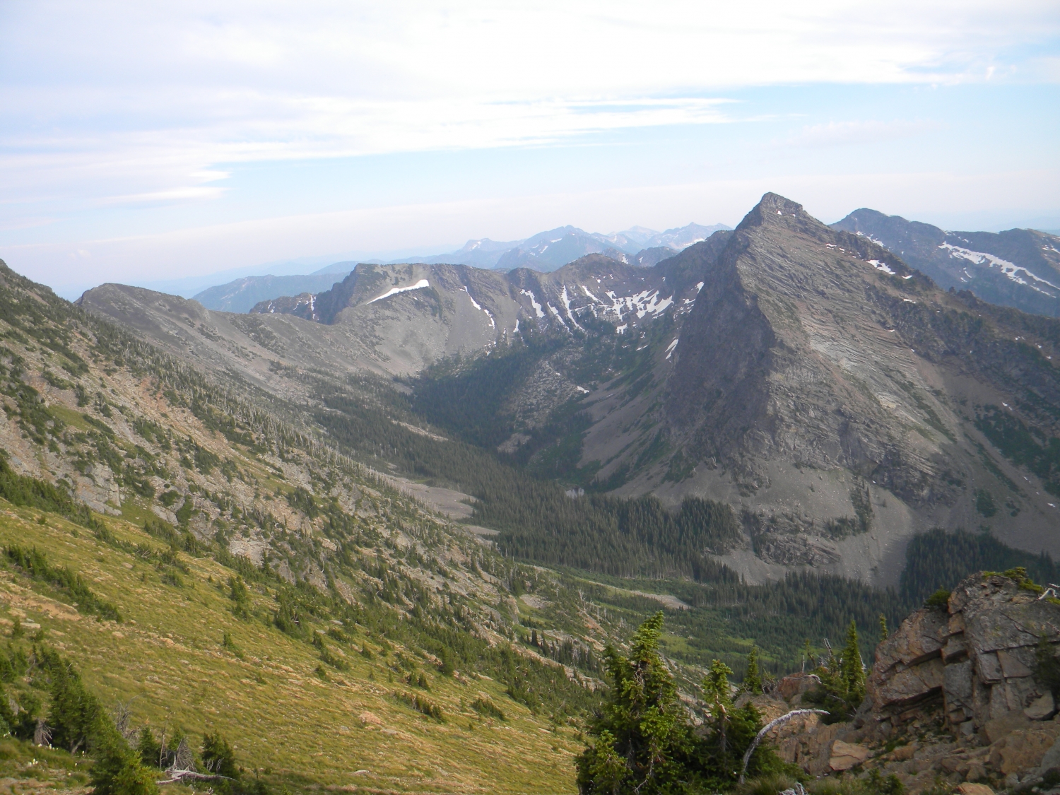
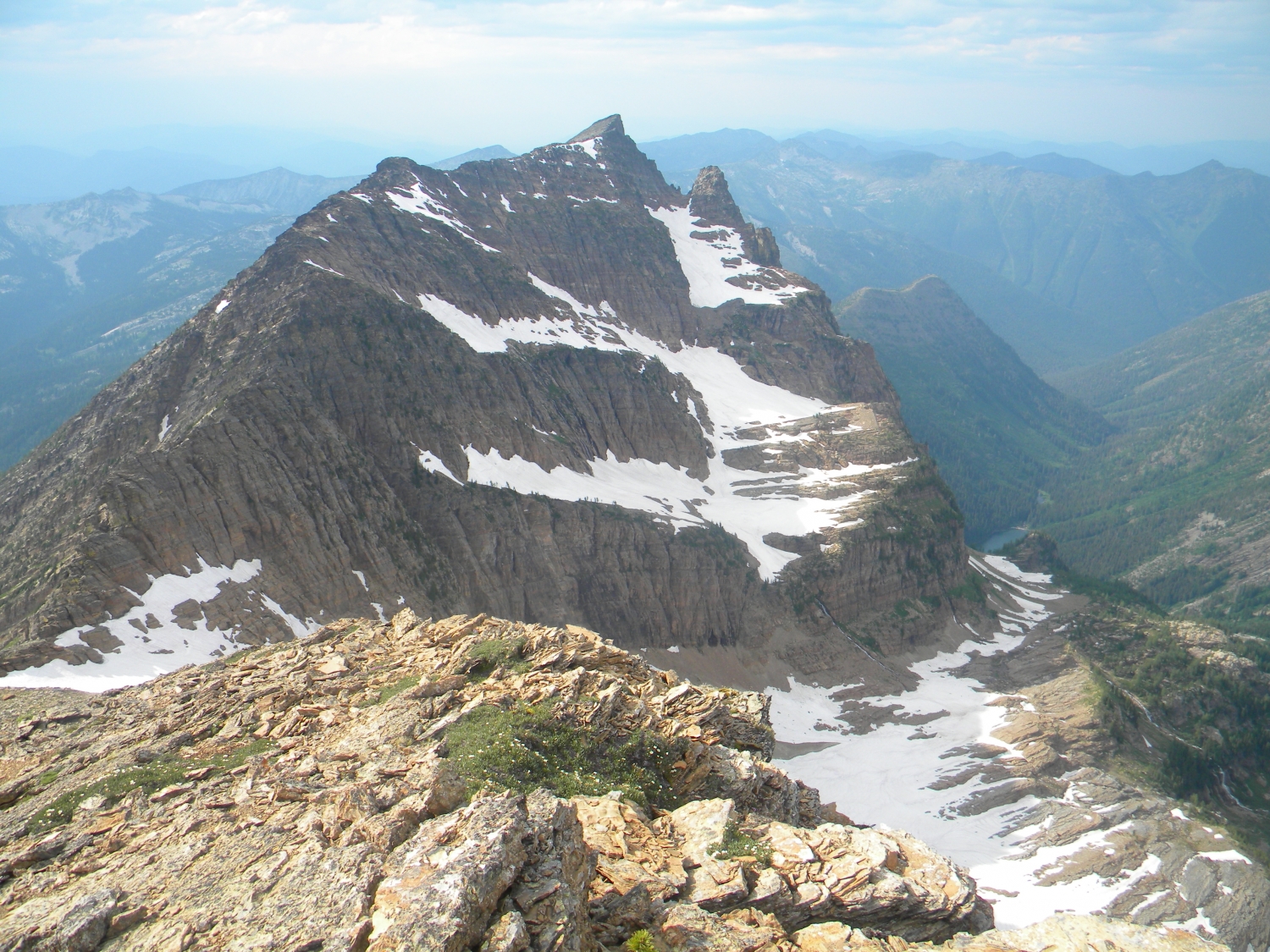
The Cabinet Mountain Wilderness offers some amazing scenic and wild hiking in Northwestern Montana. This particular route combines closed roads, trails, man-ways, cross country, and some technical hiking. The reward is traveling though two drainage to reach the highest point within the wilderness, Snowshoe Peak (8736 ft).
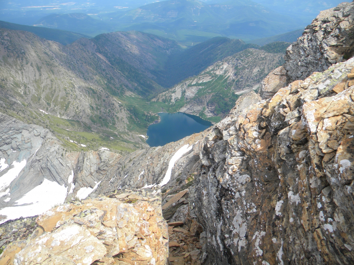
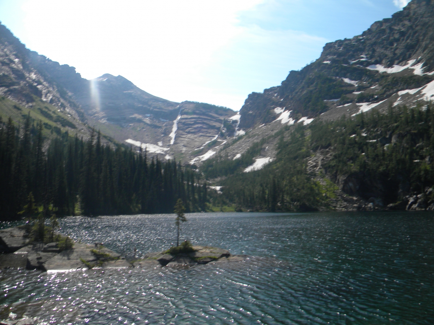
You can ignore what guidebooks prior to the recent washout tell you about the trail head. Part of the road has now become part of the river and will never reopen as a road. Therefore, this route begins where road 2722 begins. The route begins along the east edge of the river/road. After approx. a half mile a there is a junction, stay to the right. A short way past this point another road is on the right. This road is a couple hundred yards to the Middle fork of the Bull River trail. To reach the east fork continue to the left. After approx. 2 miles, of the road traveling trough a young forest, you will reach the North fork of the Bull River trail head. The first couple miles of trail, you will travel though a forested river valley to a open area of flat rocks perched beside a nice waterfall. Continue on a short distance to a fairly vague trail junction. This is the end of maintained trail. Take the right man-way trail, as it drops down to a stream crossing. After about a mile and a half the forest opens to a small pond/swamp in front of a rock slope. Scramble up the slope, and back into the trees, veering southeast, along the outlet of snowshoe lake. Approx a 1/4 mile past the pond you will find yourself at snowshoe lake. Follow the northern shore, through some great camp sites. The pass, above the lake, that leads to the middle fork of the Bull River, appears steeper than it actually is. Scramble up the rock shelves, finding your own route to the saddle. From the saddle you may choose to scramble along the ridge and up to Snowshoe peak, where you will have views of the entire cabinet range, much of Northeastern Montana, Granite lake and the steep face of A peak, Leigh lake, and possibly the goats and sheep that patrol the high crest. Most hikers will choose to return on the same route. More experienced hikers may choose to return via Ibex creek and the Middle Fork the of Bull River. This route begins with a decent down the hillside into Ibex creek. The best route appears to be a steep side hill down the slope veerig upstream. This is fairly steep and the bear grass can be slick under ones boots. Some maps show trail along Ibex creek, but this trail is no longer maintained by the forest service. Good map reading skills is a must. The now man-way, follows Ibex creek to its confluence with Bighorn creek where the two become the Middle Fork of the Bull River. From here it climbs above the river for over a mile until it drops back down to the junction with trail 980, which leads 2 miles to Little Ibex lake. To continue out, stay on trail 978 headed downstream. From this point the trail is well maintained as it meanders along and away from the river eventually making way to an old road that leads to the trail head and back to road 2722. The trail along the middle fork and Ibex creek is approx. 6 miles.
Warning: The length of this route is not exact. 2-4 miles are a rough estimate. Good map skills and experience off trail are greatly recommended. In addition, approx. 20-30 grizzly bears inhabit the wilderness. One must store food in bear canisters or hang bear bags and leave campsites clean and free of food scent. Pepper spay is also recommended.