East Eagle Creek Loop
Low Point: 4700'
High Point: 8500'
Season: Summer/Fall
Difficulty: 4/5
Directions
Follow the directions closely from the Forest Service's website (http://www.fs.usda.gov/recarea/wallowa-whitman/recreation/recarea/?recid=52377). Directions from older hiking books may be incorrect due to road closures (I used to go via a different route and that road seems to be washed out now).
Trail Description
3-5 days would be a good range for this hike, depending on ability. Going over 3 passes and scaling the side of the East Eagle Creek Valley at the very beginning, this hike has a LOT of elevation change (as with most loop hikes in the Wallowas).
The hike begins from the East Eagle Trailhead (not a campground). There are actually TWO trailheads here. Even though this loop starts on the Little Kettle Creek Trail, you'll shorten the loop a bit if you drive PAST the Little Kettle Creek Trailhead and park at the East Eagle Trail Trailhead, which is at the very end of the road.
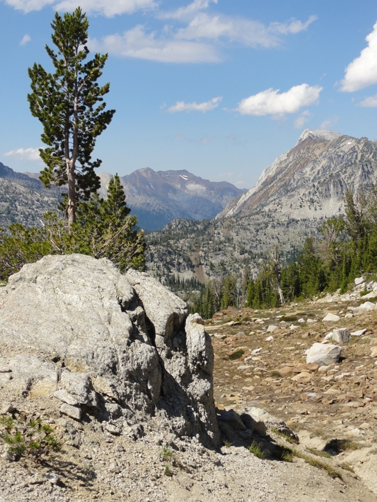
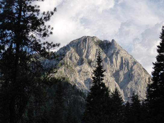
Following signage to the Little Kettle Creek Trail, you'll quickly find where this trail begins the trek up the side of the valley wall. This is a continually uphill jaunt without water until just over half way up the hillside. Don't forget to look behind you as you ascend. Great views of Granite Cliff to be had!
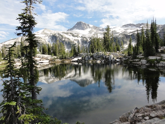
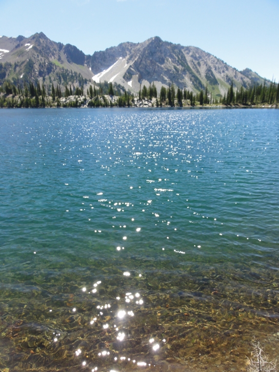
At the top you are rewarded with a visit to Crater Lake, a relaxing lake surrounded by some of Oregon's highest peaks (Red Mountain, Granite Mountain in front of you and Krag Peak and Truax Mountain behind you).
Wrapping around the lake to the left, you come to a trail junction. You'll go to the left, down the Cliff Creek Valley.
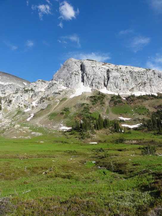
As you descend the valley there's ample water with clear, spring-fed creeks that cross the path. Red Mountain, Oregon's 14th highest peak at 9560', dominates views upcreek.
Cliff Creek ends at the South Fork Imnaha River. You'll need to ford this river, which is wide but has considerable moving water. It seems that I was there in a high-snowpack year (so the water was presumably high), but I'd imagine that this crossing could become dangerous in even higher snowpack years or earlier in the season.
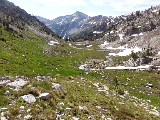
After crossing the river, you'll catch up with the South Fork Imnaha River Trail and take it up-stream. This valley makes its way gently uphill with increasingly grand scenery. As it works its way around the lower arm of Cusick Mountain there are waterfalls, meadows and peaks galore. Approaching Hawkins Pass, you'll find yourself in a large cirque, wrought with wildflowers.
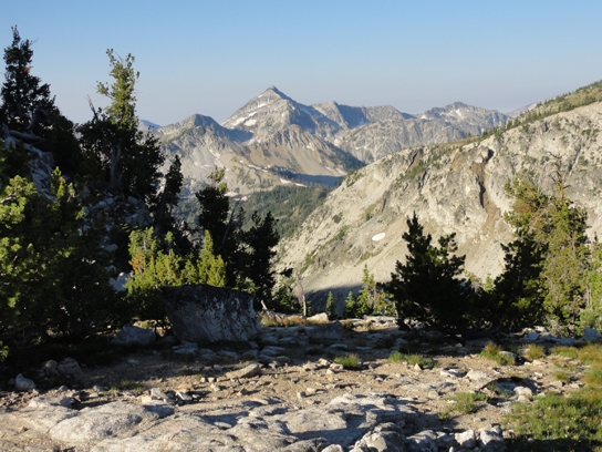
Scale the side of the cirque to the pass. At the pass you'll get excellent views of the valley you've just ascended and of the West Fork Wallowa Valley - Pete's Peak in the distance.
Descend into the valley to visit Little Frazier Lake and then, further down, you'll skirt the edge of Frazier Lake (or it's boggy headwaters, at least). One particular creek crossing in this section is quite wet.
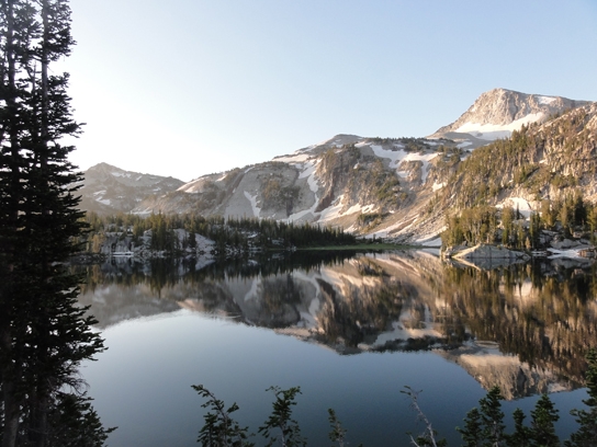
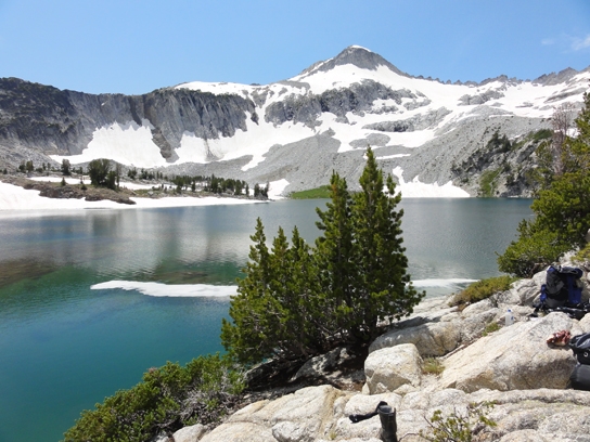
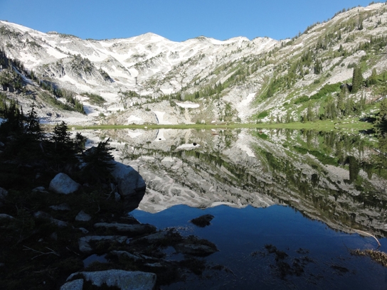
At Frazier Lake, you'll meet the West Fork Wallowa Trail - take this to the left, uphill. You're now making your way towards Glacier Lake and Glaceir Pass. The scenery increases in grandeur as you pass scree slopes that house pika families. The trail makes its way around the valley and then up to Glacier Lake. This lake is 8166 feet above sea level and at the heart of the wilderness. To me, this is the Eagle Cap Wilderness "inner sanctum". Towering above the lake is Glacier Peak (el. 9495'), which is connected to Eagle Cap Peak (Oregon's 13th highest peak) behind it. Off towards Jackson Peak the lake is almost an infinity pool, flat and reflective to the edge of this plateau. Camping is allowed here but, as with all the fragile lakes in Eagle Cap, be sure to have the lowest impact possible.
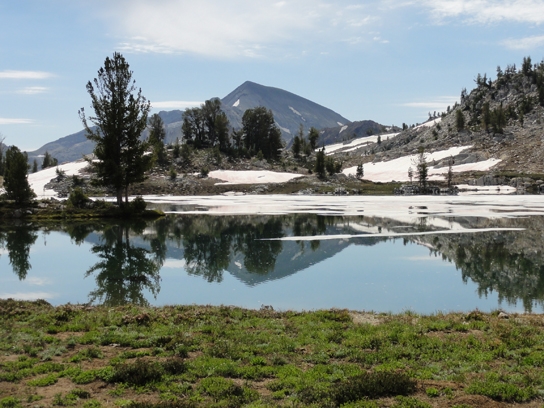
At the lake you are just below Glacier Pass. A few minutes more on the trail and you are over the pass and descending into Lakes Basin. The Matterhorn is in the distance. This mountain, with it's brown and white coloration and prominent granite cap, is really (sort of) an arm of Sacajawea, which sits out of view behind it. The Matterhorn is 12 feet shorter than Sacajawea proper, which is Oregon's 6th highest peak (the highest one outside of the Cascades) at 9838'.
Descending into the valley you'll see Mirror Lake and Moccasin Lake below you. Unless you're in a high snowpack year or early in the season, the trail will become a series of stepping stones that cross through Moccasin Lake once you get there. The high water scenario is a series of stepping stones just under the water.
Just past Moccasin Lake the loop turns left at the trail junction. You go over a small hill and down along Mirror Lake. This is probably the most popular lake in the wilderness. It sits just below Eagle Cap Peak and is truly stunning. A short side trip, if you choose to do one, is to Sunshine Lake - a photographer's dream.
Working your way around Mirror Lake you pass several trail junctions. Follow the ones up to Horton Pass (essentially, stay to the left at all times). This will walk you past Upper Lake as you ascend to the pass and give you great views down the Lostine River Valley.
At Horton Pass, views are spectacular. This is where you can opt to take a side trek up Eagle Cap Peak on the spur trail. In the distance in front of you is Krag Peak. This peak may look relatively close from this vantage point. It rests above the trailhead - which is 11.6 miles away.
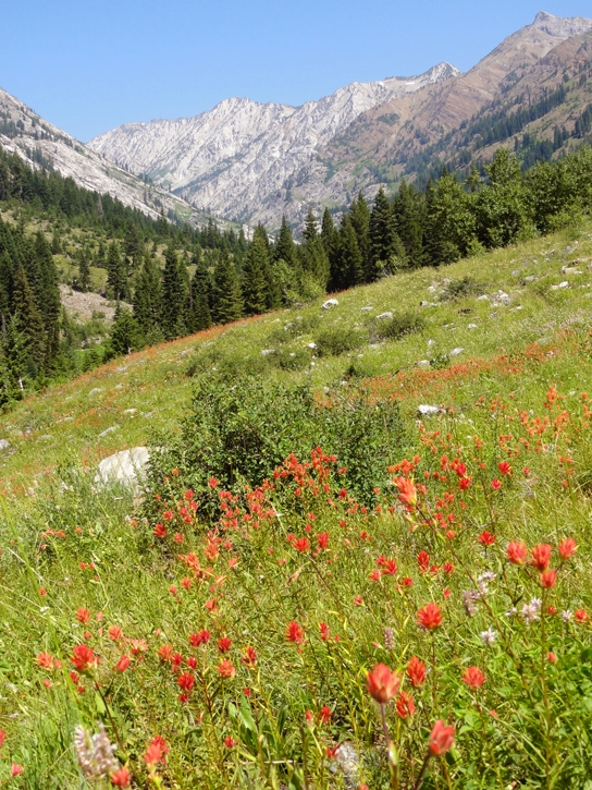
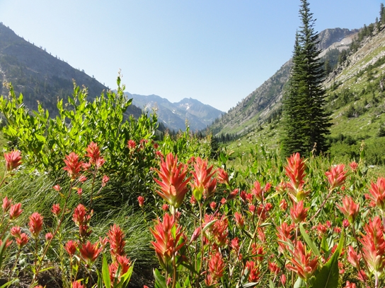
Descending into East Eagle Creek Valley, you have a long walk back to the car but one that is full of larger-than-life views of this valley. In the right time of year (mid-July) the wildflowers can be overwhelming. There is little shade in this section. If you forgot sunscreen, you are probably already sunburned, but this section will do you in.
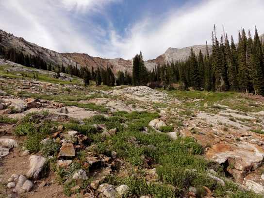
The forest service is not maintaining this (or perhaps any of these) trail(s) on an annual basis and this trail has seemed to become progressively worse with each time I hike it. The trail to Hidden Lake is a guessing game. Much of the path you'll have to intuit through heavy, overgrown brush. Near the junction with the trail that goes over Frazier Pass the trail is completely disconnected. Keep your eye out for the pass for this reason. Frazier Pass is heavily treed (that's how I recognize it, along with looking at the map) and the trail connects to the East Eagle Trail downstream from the pass itself. Near this junction the trail you've been following will pretty much end. Following a dry creekbed towards East Eagle Creek will hook you up with the trail again (which, at that point, is pretty obvious). You'll want to continue downhill/downstream on the trail as going the other way is the route over Frazier Pass.
After all of that the trail is not as elusive. Rewarding you along the way (if you're there at the right time) will be an abundance of huckleberries near the end of your hike. As you see Granite Cliff come into view and then become parallel to you across the creek you know you are nearing your vehicle.