Rebel Rock Loop
Low Point: 2045'
High Point: 5311'
Season: Summer/Fall
Difficulty: 4.6/5
Directions
From Eugene, drive Highway east on Highway 126 for 45 miles, past the town of Blue River to a sign pointing towards Cougar Reservoir. Take this fork, turning right again at an intersection a mile down the road. Follow this road along the banks of Cougar Reservoir for another 13.5 miles to the Rebel Rock Trailhead on the left side of the road.Trail Description
This loop trail samples some great country on the western edge of the Three Sisters Wilderness. Hikers will experience a nice valley bottom hike with a beautiful creek and tall stands of trees, great views of the Three Sisters, an old lookout, and some nice ridge top meadows.
Shortly after the trailhead, the trail splits. If you are going to make the suggested loop, stay left, for this trail gives the hiker a more gradual ascent to the ridge top. The valley bottom trail stays near the creek for the first mile, crossing it twice before climbing higher along the canyon walls. Thick underbrush, including rhododendrons, which bloom in early or mid June, cover the forest floor while tall Douglas Fir trees loom overhead.
Near the four-mile mark, the trail reaches the confluence of North and South forks of Rebel Creek. A nice campsite is located here and the area makes for a nice break if needed. The trail crosses the South Fork and continues for another mile to a fork. Take the trail to the right, where the first good views of the Rebel Creek Valley are attained. Views continue to get better as the trail passes under the western flank of Rebel Rock. Soon, the trail emerges on the southern face of Rebel Rock Ridge giving a nice view of the rolling hills to the south, Mt. Bachelor, and a partial view of the South Sister.
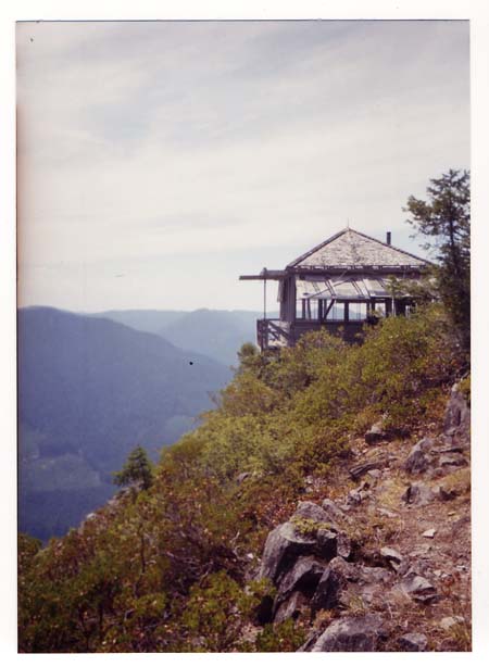
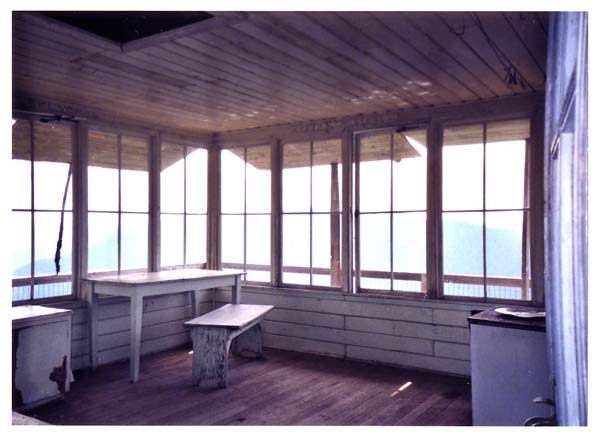
After a short hike along the ridge, the Rebel Rock Lookout comes into view. The side trail to see this relic is a little hard to find. The trail intersection is marked with a small rock cairn just before a ridge-top rock field. Take this overgrown trail a short distance to the old lookout for a great view of the valley below.
The main trail stays along the ridge top, eventually climbing past a helicopter landing area (to re-supply the old lookout), and to a 5,311 ft. high point. The view of the Three Sisters, Mt. Bachelor, and even Mt. Jefferson are the best here, and the flat open area at the top of this rise makes a great lunch spot.
Continue on the trail as it starts its descent through a large open meadow at the head of the Trail Creek Valley. Once reaching the valley floor, trees overtake the views, but the very large trees, open forest, and beautiful creek make the hiking great. The forest gets denser as the trail descends, and eventually emerges on a small ridge before dropping back into the South Fork McKenzie Valley and your car.