Canyon Creek Meadows
Low Point: 5100'
High Point: 6000'
Season: Summer/Fall
Difficulty: 0/5
Directions
From Santiam Pass, drive east for eight miles until reaching Forest Service Road 12, and a sign for “Mt. Jefferson Wilderness Trailheads”. Turn left on this road and drive for four miles until reaching Forest Service Road 1230. Turn left onto this road and follow it for 1.4 miles, veering left onto Road 1234. The trailhead is located after another five miles of steep and washboarded road. Two trails lead from the trailhead, make sure you take the trail at the north end of the parking lot.Trail Description
It’s easy to get to some amazing scenery in the central Oregon Cascades, unfortunately the ease of entry makes this hike extremely busy. I suggest that the hike be done during a weekday morning to avoid the crowds.
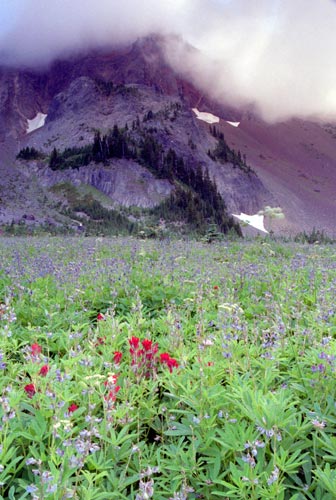
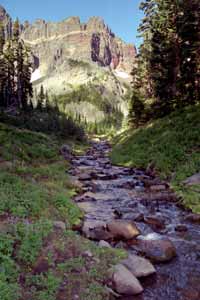
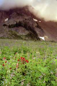
The trail leaves the parking lot and immediately passes Jack Lake along its eastern shore before ascending the ridge and reaching an intersection. Due to the overuse of this path, the forest service has made this into a one-way clockwise loop trip to decrease the amount of other people you’ll encounter. Taking the left fork, the path continues a gentle climb through an open lodgepole pine forest for the next mile, passing several small meltwater ponds before dropping down into the meadows and fields of Indian paintbrush, lupine and multitudes of other wildflowers. The meadows reach their peak in mid to late July (along with the mosquitoes).
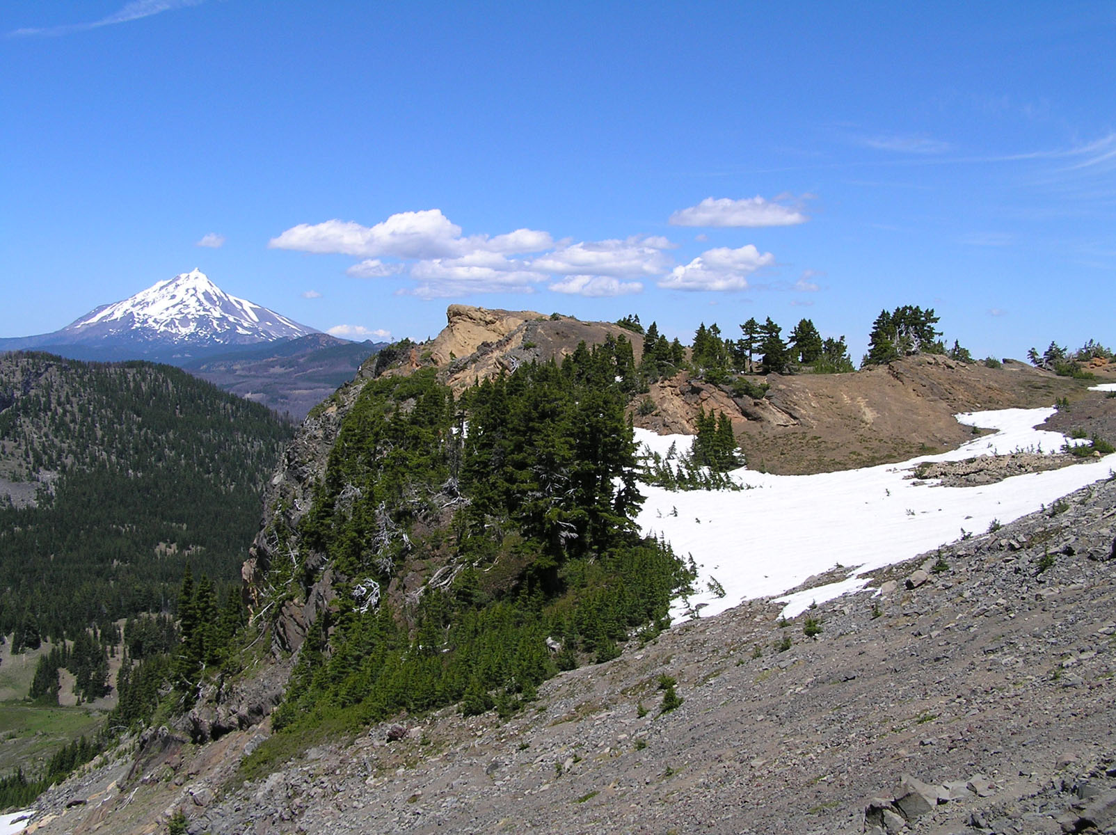
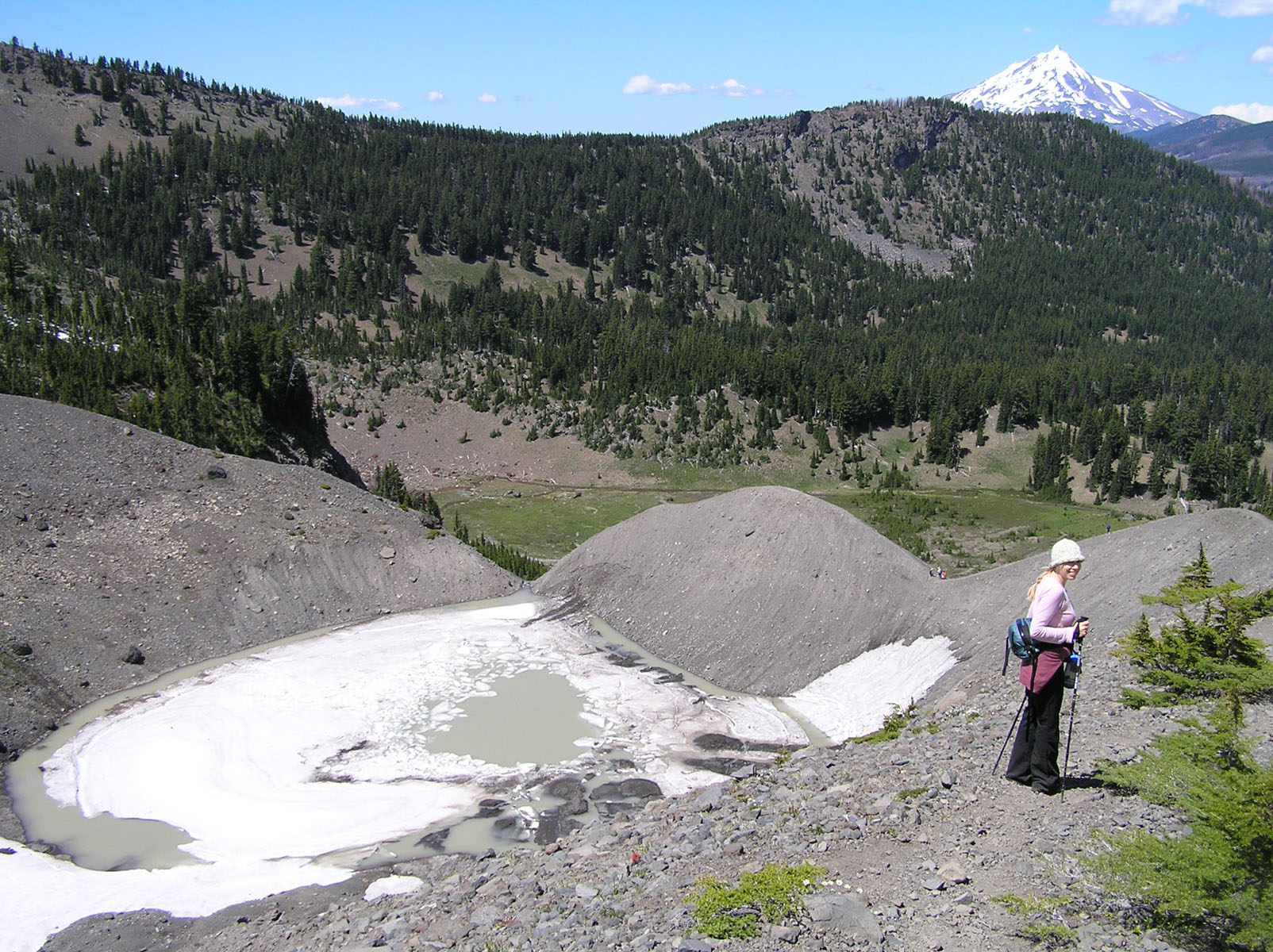
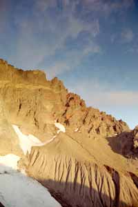
At the two-mile mark, the trail reaches an intersection. Take the left fork and hike three quarters of a mile to reach the cutoff for the upper meadows with the shear north face of Three Fingered Jack rising from the valley floor. Continuing another quarter mile along the main trail will lead to a very impressive overlook of a small lake under one of Three Fingered Jack’s permanent snowfields. This overlook also offers a great view of Canyon Creek Meadows below and Mt. Jefferson to the North. More adventurous hikers can continue the climb along the ridge to the south for a good view of the Three Sisters, Mt. Washington, and Broken Top.
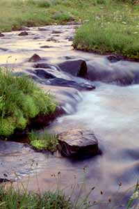
To continue the loop trip, continue back to the intersection, this time taking the left fork, which follows Canyon Creek as it meanders through meadows and over waterfalls. One mile from the intersection, the trail drops to reach another trail crossing. To return to the trailhead, take the right-hand fork and follow it for another mile. To see more country, stay left crossing Canyon Creek at a tumbling 20-foot waterfall (the trail crosses canyon creek on a narrow and fairly high log bridge, which may cause problems for those of us with balancing problems!). Past the creek, the trail drops for a half mile to reach beautiful Wasco Lake.
With the many lakes surrounding the area, an entire afternoon can be spent exploring. The area also offers access to many other trails, including the PCT, so many different hiking options are available.