McCall Basin
Low Point: 3335'
High Point: 5146'
Season: Summer/Fall
Difficulty: 3/5
Directions
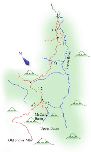
Drive Highway 12 east from Packwood for 29 miles until reaching a sign for Clear Lake. Turn south (right) onto Forest Service Road 12 and follow this for 2.5 miles to the south side of the lake. Take the fork to the right (Forest Service Road 1207), and follow this until it ends at the trailhead and a small campground.Trail Description
The trail progresses from the trailhead, staying fairly level for the first quarter mile of the trip. Almost immediately (probably 1/5 of a mile from the trailhead), a trail splits off to the left. This leads to Tieton Meadows and to the summit of Bear Creek Mountain. Take the fork to the right, and follow the trail as it slowly starts climbing up towards Tieton Pass.
A faint side trail takes up the ridge at one mile, leading to Shoe Lake. Continue straight on the main path, through the nice mountain forest. Occasionally, the forest will open up enough to offer views up the valley. The grade of the trail continues its moderate pace, making this trail quite pleasant and enjoyable. There are several stream crossings, which may require getting a little wet early in the season (although none of the crossings are particularly dangerous).
The trail reaches Tieton Pass and a five-way junction at 4.5 miles. Take the trail directly to the left (the Pacific Crest Trail). Be sure to look to the north through the trees for some views of Mt. Rainier. The grade continues to be gentle as it reaches for another saddle in the ridge and a small lake known as Lutz Lake. While the lake does not offer any spectacular views, it is very pleasant and tranquil. There are several campsites around the lake. Continue past Lutz Lake for a half-mile until reaching a trail forking to the left. Follow this down for a half mile, and into McCall Basin.
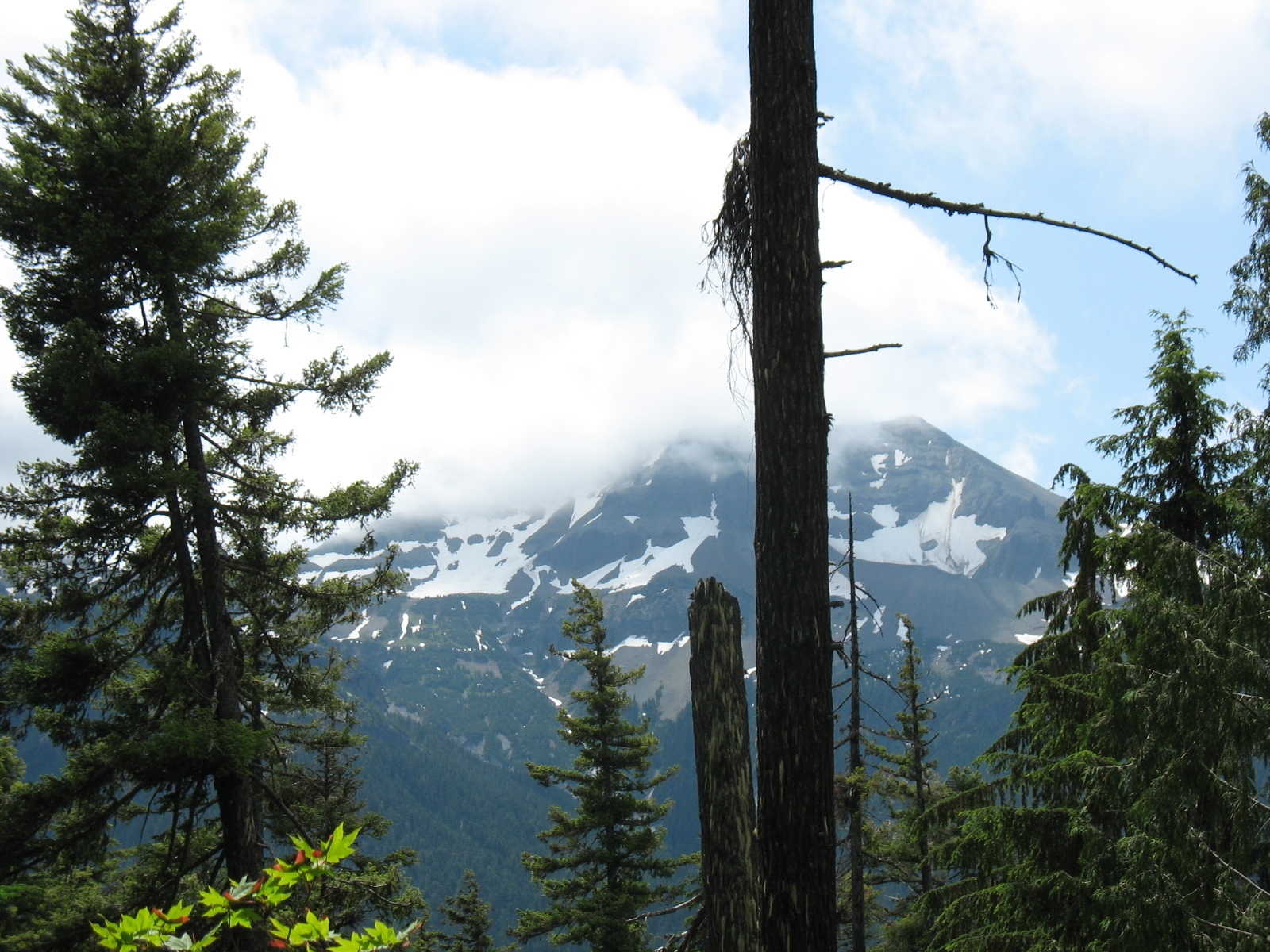
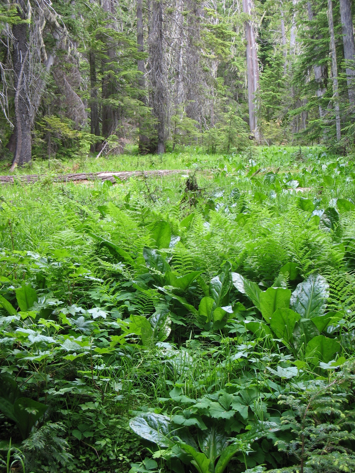
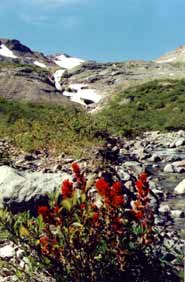
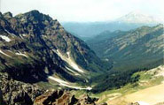
McCall Basin is a wonderful meadow. Early in the season, it is probably covered with mosquitoes, but there are probably also some great wildflower displays. There were still some impressive wildflower beds present on our trip in Late August. The most prominent mountain is Tieton Peak, while most of the other peaks in the area stay hidden behind ridges to the south of McCall Basin. Set up camp, explore the basin, and relax a little. Above all, make sure you have at least one full day to explore the area, because those mountains south of McCall Basin are very impressive.
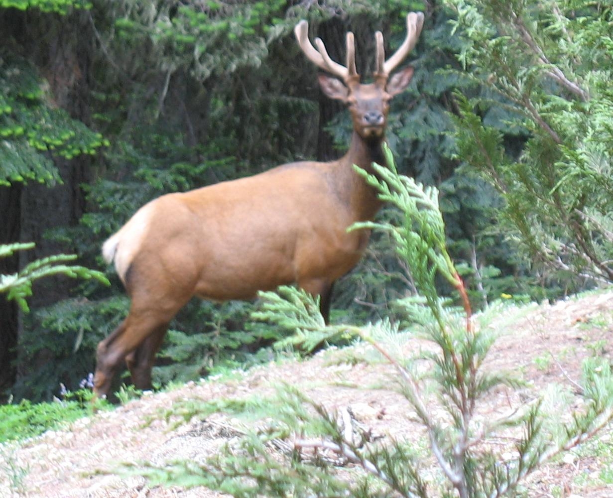
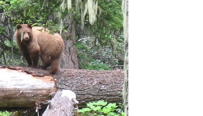
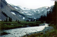
For a must do side trip, follow the paths through the basin to a small saddle in the ridge directly to the south of the basin. A well-worn trail leads through the gap, giving great views of the valley below. Also make sure to scramble slightly down the hill to see an impressive waterfall. Continue to follow the trail through the pass. In a short distance, the terrain will open up, revealing a very impressive valley under the flanks of Old Snowy Mountain. Herds of elk and mountain goats can be seen in this valley, so you may want to bring your binoculars.
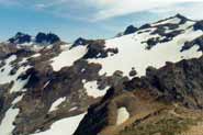
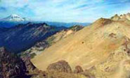
For those of you seeking more of challenge, follow the creek to the headwall of this valley, and to the Pacific Crest Trail. Portions of the climb can be quite difficult, but the views from the ridge are spectacular. The remaining mountains of the Goat Rocks rise to the south, Rainier to the North, and Mt. St. Helens to the west. To return to camp, follow the PCT north from here, eventually coming to the fork that leads back down to McCall Basin (roughly four miles from the headwall).