Lower Lewis River
Season: All Year
Difficulty: 0/5
Directions
From Cougar, Washington, drive east on Highway 503 (which becomes Forest Road 90) for 20 miles. Turn left on Road 9039 and follow this road for three quarters of a mile to the parking area located on the south bank of the river. Cross the bridge to reach the trailhead.Trail Description
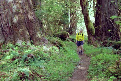
This trail travels along the Lewis River, a beautiful canyon with a feeling of remoteness not easily found in this part of the Cascades. This is perhaps one of the only river bottom hikes in Western Oregon or Washington (excluding the canyons within national park boundaries) that has a wide valley bottom with a large, beautiful river, huge trees, and little sign of human interaction, such as large clear-cuts or roads penetrating the canyon.
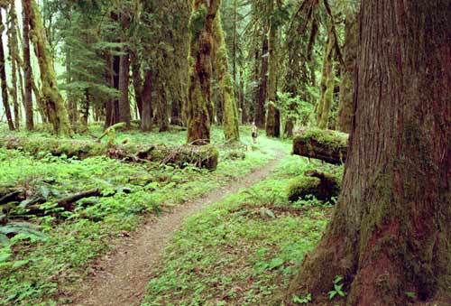
From the trailhead, the narrow river canyon soon opens up to a wide braided river channel with wide meadows and broad open forests. At the two-mile mark, the trail passes by an old shelter, along with a nice little camp area right alongside the river. Past the shelter, the trail exits the previously logged area (which has nicely recovered from its past), and enters into a very impressive forest of much older age. Many of the Cedar trees are near 10 feet or more in diameter at their bases, with many large Douglas Fir trees interspersed. Beneath the towering trees lies a green carpet of typical northwest groundcover, including a variety of ferns, oxalis, and wild strawberry right alongside the river. There are several great campsites along this stretch of the trail.
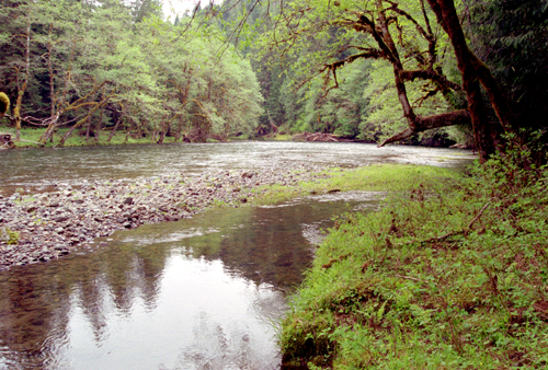
The scenery stays great as the trail turns in a more northerly direction. Eventually the river changes its character once again, from the wide valley bottom to a more turbulent character as the canyon narrows and cliffs rise on either side of the river. A multitude of small streams fall over these cliffs creating a variety of waterfalls. The trail starts climbing the canyon wall and slowly strips away the large, towering trees for a smaller fir dominated hillside forest. The river at this point works its way through the impressive canyon, with steep cliffs, which explains why the trail needed to leave the river’s edge. The trail reunites with Forest Service Road 90 after nine miles, but the Lewis River Trail continues on for another five miles.