Columbia Gorge

Benson Plateau

Length: 16.5 round trip miles
Low Point: 80'
High Point: 4150'
Season: Summer/Fall
Scenery: 4/5

Difficulty: 3/5

Submitted by: Forrest

Directions

From Portland, Drive East on I-84 to the Eagle Creek exit, number 41. Turn South and follow the road a short distance to the trailhead. From the east, drive to the Bonneville Dam exit, and re-enter the freeway eastbound, taking the Eagle Creek exit.
Benson Plateau

Trail Description

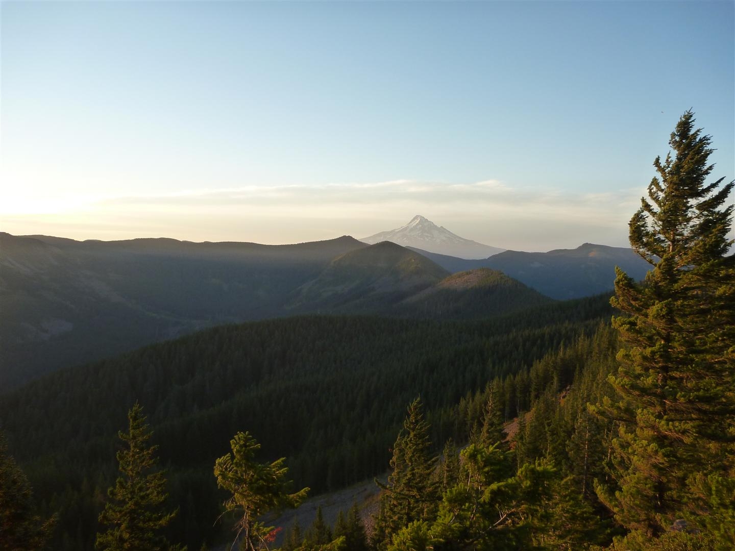
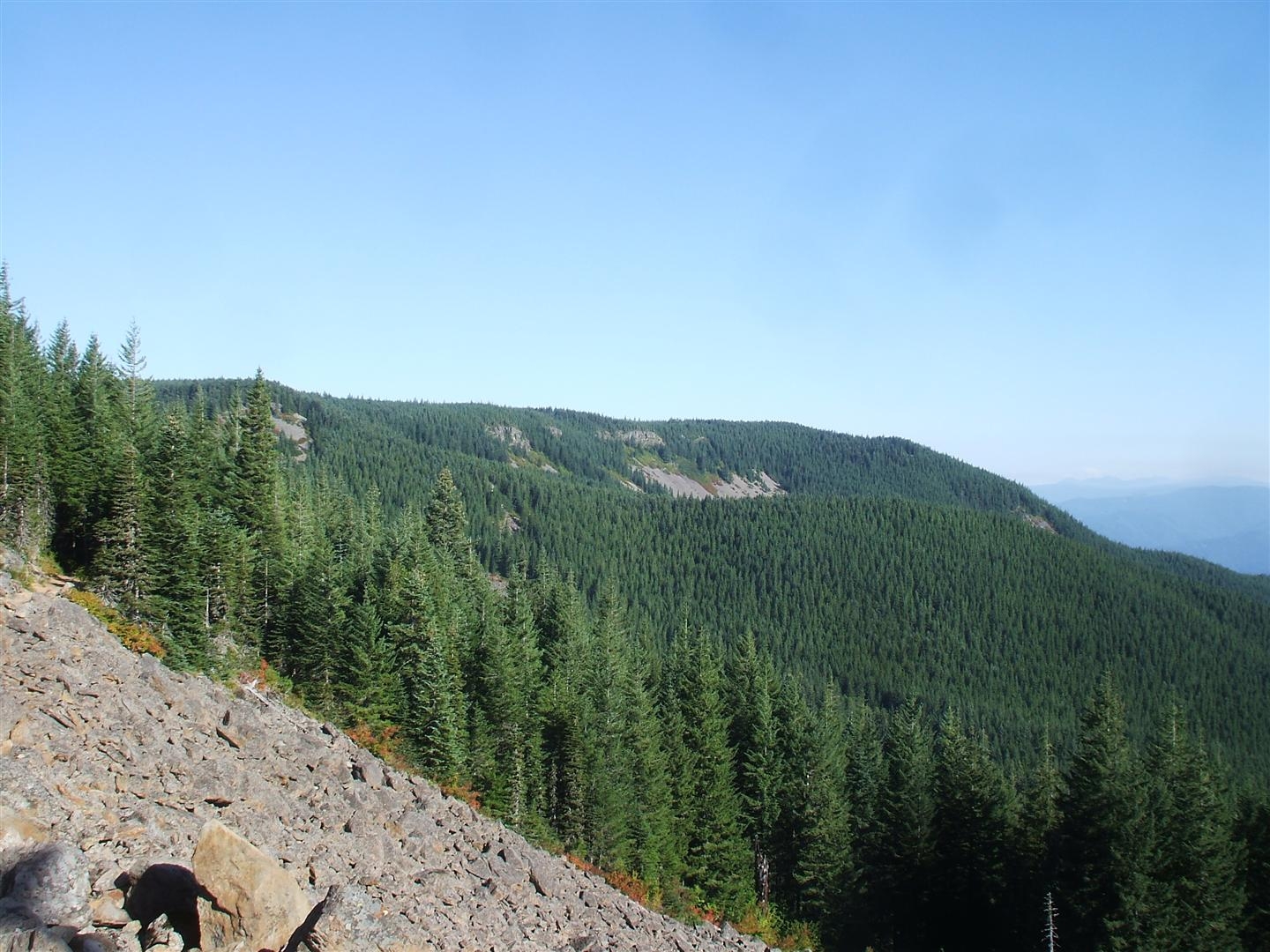
The Benson Plateau loop is a tough 16.5 mile trip beginning in the beautiful Eagle Creek Valley, before steeply rising to the plateau and good views of Mt. Hood and the Gorge.

The first 5 miles follow the Eagle Creek Trail through the green and waterfall-filled valley. Just beyond Wy'East Camp, look for a trail leading to the left and making a nice grade up the valley wall (on our trip, there was some red caution tape hanging from the trail sign...always a comforting sign). The trail immediately breaks onto an open slope before re-entering the woods where the lack of trail maintenance is evident. The trail crosses the Wy'East Creek (no issues crossing), and again begins to climb emerging onto steep open slopes again. Wy'East Falls can be seen, but care should be taken through this section, since the steep slope could result in a serious fall.

The trail reenters the woods and stays mostly along the ridge line as it makes its way steeply towards the PCT. 1.5 miles from the Eagle Creek Trail, the path enters a burned area. Some views of the valley are gained, but the overgrown brush and fallen trees slow progress substantially. The burned portion lasts for a mile with the trail entering and leaving it several times. At 2.5 miles, the trail enters the woods with some finality, and the walking improves. There is a nice vantage point with views towards Bonneville Dam and the Columbia River to the north. The trail continues at a nearly level grade until crossing a small creek, and then meets the Pacific Crest Trail, a rough three miles from the Eagle Creek Trail.

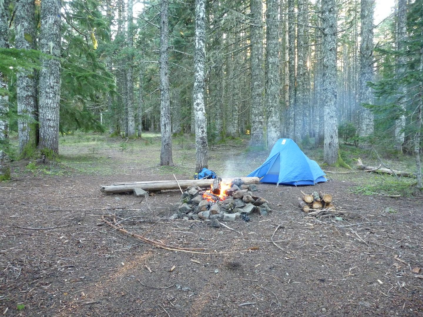
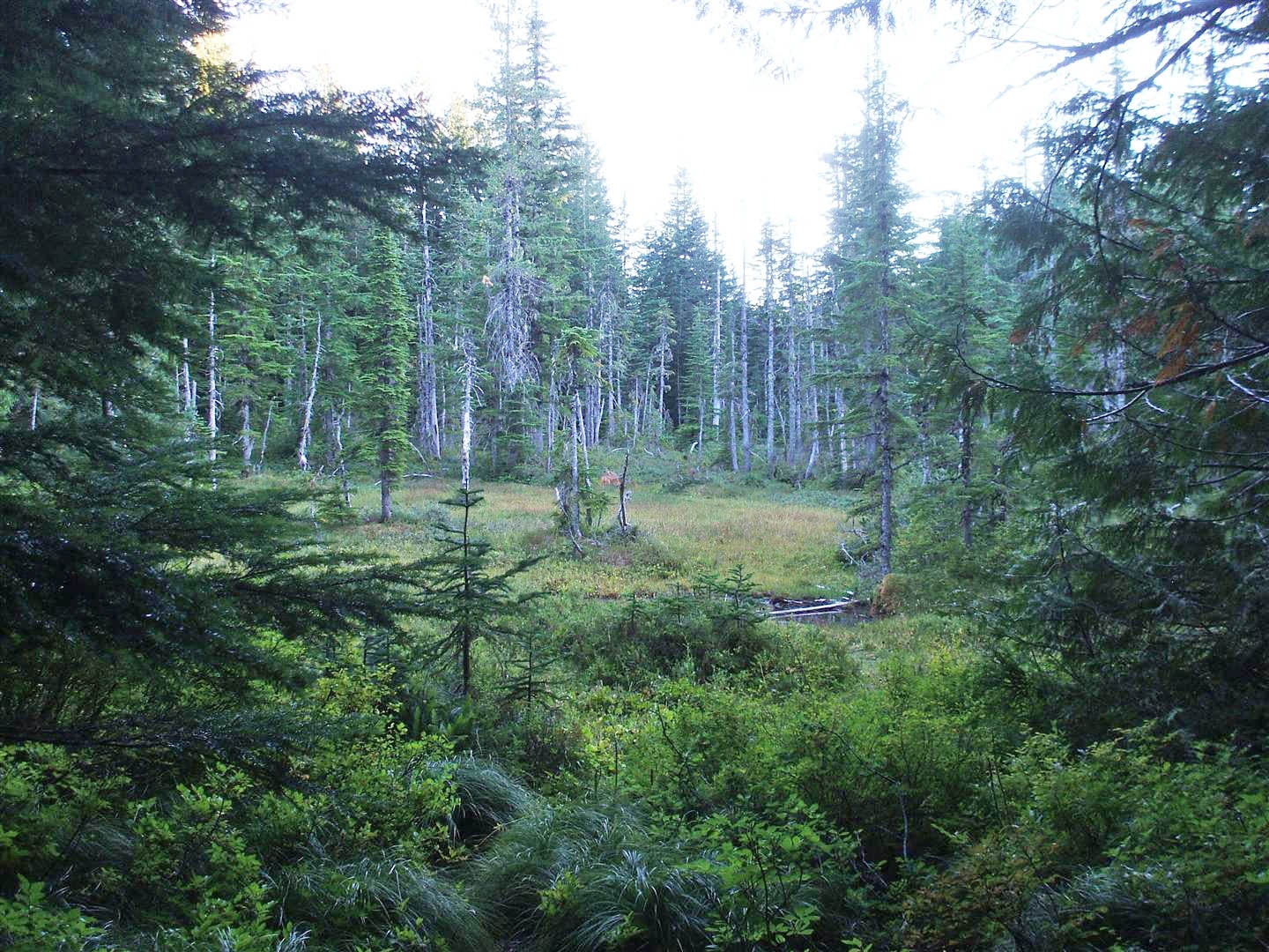
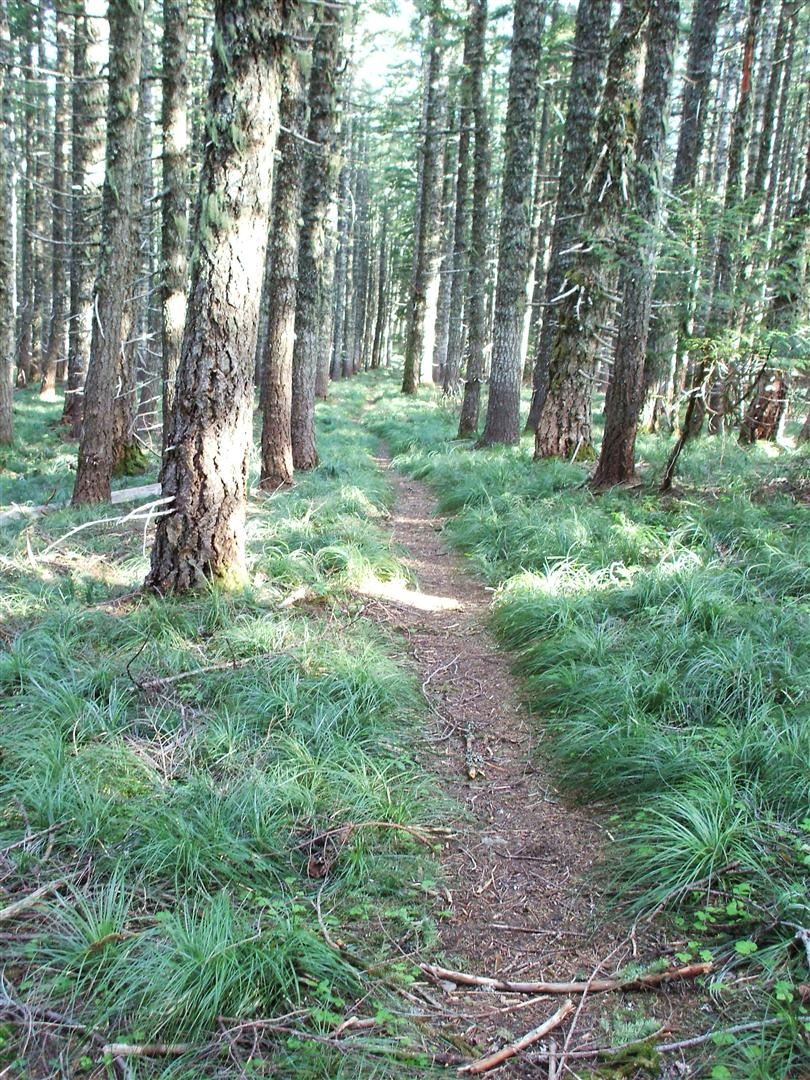
Compared with trail 434 (the one you just came up), the PCT is great. The grade is perfect, and the walking is easy. Mt. Hood can be seen to the south, as well as the Herman Creek Valley, and Tomlike Mountain. Walk the PCT for 1.25 miles until a signed fork for the Ruckel Creek Trail (405). The level trail passes several nice campsites, and a few ponds (with their mosquitoes) before crossing Ruckel Creek on a small bridge, and then meets trail 405C. Stay right at the intersection as the trail begins to drop, crosses the creek again (no bridge, but no problem), and begins working its way down the ridge. There are several nice campsites just beyond the creek crossing. The trail steeply descends before it levels out and pulls away from the creek. It passes through some broad meadows with good views and emerges along the ridge line, where views of the Gorge, Cascade Locks, and Mt. Adams warrant a much needed break. The path once again steepens its grade, before leveling out and crossing under a set of power lines before emerging on a service road next to I-84. Walk the road towards the west, or take the Gorge trail which appears a short distance down the road back to the Eagle Creek Trailhead.

This loop trip is also a good way to experience the Eagle Creek Trail, without the crowds. We arrived at 9:00 in the morning, before most of the crowds appeared. Since we didn't need to return on the Eagle Creek trail, we missed all of the afternoon crowds, and once we left the Eagle Creek Trail, we didn't see another person.

Comments

Benson Plateau is one of my favorite camping/hiking spots! I suggest you pass on Ruckel Creek Trail, Herman Camp or Eagle-Benson and approach the Plateau from the south, hiking up from Wahtum Lake, via The Pacific Crest Trail. To drive to Wahtum Lake you'll do it from from the town of Hood River: Travel southwest on Primary Forest Route 13 past Dee. Continue on 13 follow it west when it splits. About one mile past forest boundary, pick up Forest Road 1310. Follow 1310 northwest to the campground. Then, it's a pleasant, non stressful 5 to 7 mile hike on Pacific Crest Trail. It's only about 5 miles to Camp Smokey on the South Side of Benson Plateau, about 7 miles if you hike on to Benson Camp. The plateau can be buggy, especially when it's hot! But it is a very interesting place to explore, several trails cross the mostly flat plateau. There is great water at Benson Camp, Hunters Camp and a small creek less than a mile below Camp Smokey on the Eagle-Benson trail.
2012-12-03 12:06:18
Just completed this loop hike (Ruckel Creek to Benson Plateau to Eagle Creek) on 7/16/2011. Not wanting to come back down the steep grade I just came up (Ruckel Creek), my boyfriend & I decided to make a loop of it by taking the Eagle Benson/Trail 434 to Eagle Creek. Be forewarned, trail 434 is not maintained! You wouldn’t know this descending from Camp Smokey as the first quarter to 1/3 of the trail at the top is in good condition. Once you enter the burn zone with the canopy gone, the undergrowth has had a chance to mature and in many spots, has obliterated the trail. Had there not been hikers in front of us bending vegetation out of the way, I'm quite certain I would have lost the trail. This also slowed our pace. As another web page indicated, "the Eagle-Benson Trail takes a 3 mile, 3000' dive into Eagle Creek Canyon." They're not kidding! Very few switchbacks; pretty much straight down (or straight up). This is where my boyfriend & I ran into trouble as our knees & legs turned to mush. Again, slow going. As we approached Eagle Creek from above, the tread of the trail narrows along the cliff-side (there is a waterfall in view), mostly covered in small loose rocks. This was dangerous & a bit frightening for us based on the condition of our now wobbly legs. A fall here would have been the end. Now, I do take some responsibility in not doing my homework ahead of time in reading about the alternate trails I may consider on my planned hike & their condition, but I truly feel the Forest Service should place a sign at each end of trail 434 indicating that it is a primitive/lost trail and to proceed with caution as it is not maintained. In the end, this trail is still doable; one just needs to take care. Either route one takes there’s a steep up and a steep down but I think I’d rather take trail 434 up and Ruckel Creek down as that trial is in better shape with plenty of switchbacks. Otherwise, Ruckel Creek to the PCT, taking the PCT north to Cascade Locks and returning to Eagle Creek by way of the historic Columbia River Highway State Trail would make a great loop knowing the PCT is in much better condition.
2011-07-18 22:41:11
Did this trail on 6-9-2011. STarted at the eagle creek trailhead and hiked up Ruckel Creek to Bendson Plateau. Different approach from the one listed but I think my experience is still pertinent. Ruckel Creek to Benson is VERY strenuous. I am a seasoned backpacker and found the trail to be a challenge. I would suggest eagle creek to Benson and down if you want to experience this hike. Switchbacks till about the 4 miles range (up Ruckel), then straight up to Benson. I would consider this a training hike. Nice views and beautiful scenery. If you know the trail is very steep and are still game, go for it. Beautiful meadows and there was a brooke with fresh, spring water. Camping on Benson-lots of flat spaces. Still had some snow even in June.
2011-06-14 20:23:42
Attempted on 4/22/2011. Know it's early in the season (especially this one), but wanted to give it a go regardless. Trail conditions on Eagle-Benson extremely poor. Lots of fallen trees. Still, a pleasant (if extremely strenuous) climb. Began encountering snow at the 2,800 foot level, though patchy and hard-packed at first. Turned back at 3,300 feet as the snow was at that point in drifts 6' deep or more. The trail was also completely buried. Even with map, compass, and GPS, we were flying blind (and falling down in the snow), so decided to turn around. Absolutely gorgeous, will attempt again in a month or two.
2011-04-24 12:14:41

Images