Strawberry Mountain Loop
Low Point: 5760'
High Point: 8300'
Season: Summer/Fall
Difficulty: 0/5
Directions
From Prairie City, turn south on Main Street and follow this road 11 miles to Strawberry Campground. The last few miles are on gravel, but passable by passenger cars.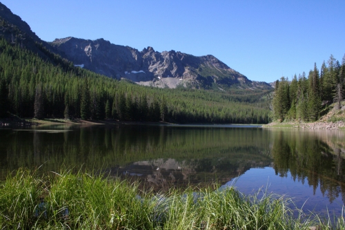
Trail Description
Rising sharply from the John Day River Valley, the Strawberry Mountains are a small, but beautiful mountain range that doesn't see too many visitors but pack in some great scenery. The Strawberry Mountains are definitely off the beaten path. Getting up to Strawberry Lake had been on my list for quite a few years, but I'm glad I finally made the time to visit this beautiful gem of a wilderness. This loop trip samples some of the best scenery in the area, connecting Strawberry Lake, High Lake, and Slide Lake.
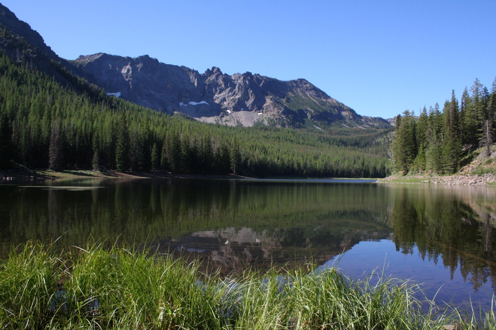
From the trailhead, the trail gradually climbs for a little over a mile to reach Strawberry Lake. It really shouldn't be this easy to reach such a beautiful mountain lake -- it seems like the range, for being so isolated, has overcompensated and made some great scenery a little too easy to get too once there. The lake sits below the rugged cliffs of the main spine of the Strawberry Mountains. Explore the lake, a side trail leads down, and circles the lake. When ready, continue straight, as the trail climbs past the lake, meeting up with Strawberry Creek, which it follows for the next half mile until reaching Strawberry Falls. Just past the falls, a side trail leads off to Little Strawberry Lake. Continue to the right.
From the trail intersection, the trail climbs about a 1000 feet for a mile-and-a-half to a small saddle, before turning more westerly above a pretty nice meadow. There are views along the climb of the Strawberry Mountains, and Strawberry Lake below. The trail reaches another saddle, and trail intersection. Stay left to continue the loop (the trail to the right climbs to the top of Strawberry Mountain)
The next 1.5 miles stays fairly level, as it stays near the 8,200' level. The area to the west of the trail, and down in the valley appears to have recently burned. Soon, the trail meets another trail intersection. Stay to the left, as the trail, which is an old road bed for this section makes its way to the Roads End Trailhead. From here, follow the road to the left (east) for about a half mile, until reaching the High Lake Rim Trailhead.
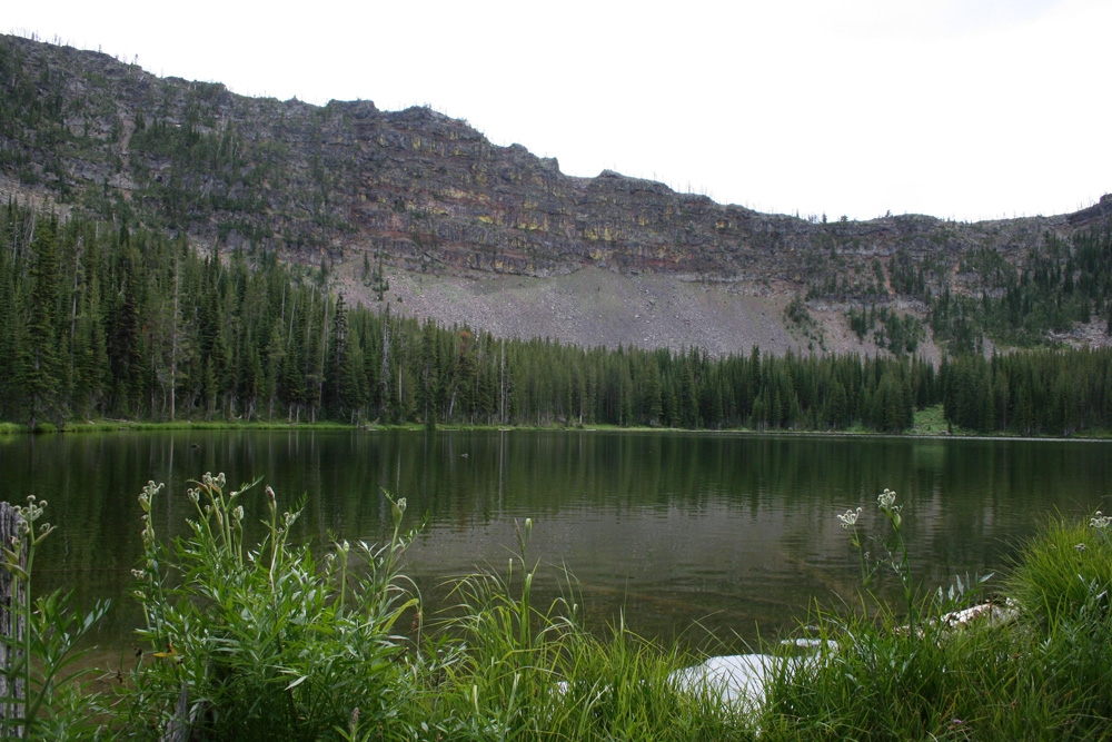
The trail then descends for the next 1.5 miles, until reaching High Lake, a nice lake tucked just below the crest of the range, with several campsites available. Continue past the lake, as the trail climbs to the crest once again. Continue straight at the trail intersection with trail #379 (1.5 miles past High Lake) as the trail begins to descend into the Slide Creek Valley. Nice views of the valley spread to the north.
After another 1.5 miles, a side trail leads to Slide Lake, a worthy detour, since it's less than a quarter mile to the tranquil lake.
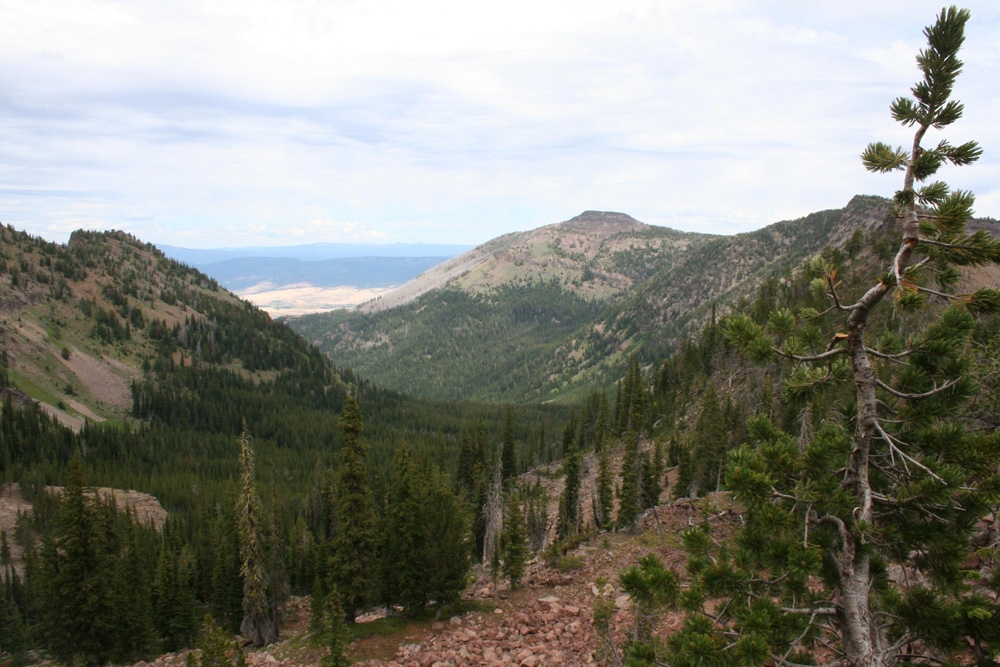
Below Slide Lake, the trail continues to descend at gentle pace. Views of the Blue Mountains, and the rugged Elkhorn Ridge lie on the horizon (wouldn't it be nice if there was a trail connecting these small ranges of eastern Oregon?). Follow the trail as it turns to the west, and finishes it's descent to the Strawberry Lake Trail. Turn right, and follow the trail that you came in on for one mile, back to the trailhead.